ready for impact svg

Ready for Impact

Apply for ready for impact by may 1st

Ready for Impact Showcase

October 2026

Participants

Scientists, researchers & humanitarians

Get Involved

Applications Closed

Program occurrence

Annual

Keep me Up to Date

Let us know what programs you are interested in and we will

Get in Touch!

Name(Required)
This field is hidden when viewing the form
Select the programs you are interested in
This 4-month incubator program includes a workshop series and a virtual pitch showcase to support tech-savvy humanitarians and scientists who are ready to scale proven applications of satellite data and tools to improve humanitarian decision-making before, during, or after a crisis.

The NASA Lifelines team facilitates access to data and makes connections with funders, providing technical support and mentorship that enable finalists to advance novel applications of satellite technology to help frontline communities in need of humanitarian assistance.

Innovators from non-profits, community service organizations, humanitarian groups, purpose-driven companies, and research institutions are invited to apply to the program either as individuals or in partnership.

2026 Ready for impact Showcase

see ready for impact in action

WhatsApp Image 2026 07 06 at 8.49.49 AM 1

NASA Lifelines Team Returns from Colombia, Ready for Impact Pitch Showcase and Mural Unveiling

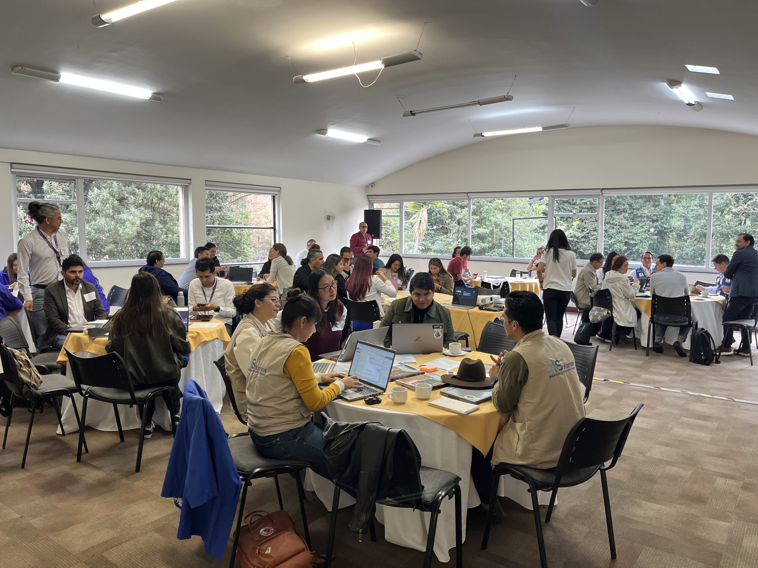
The NASA Lifelines team traveled to Bogotá to host the Ready for Impact Pitch Showcase, where eleven teams presented satellite-data solutions for early warning and disaster response. The trip also marked the unveiling of the second Crisis Readiness Accelerator mural.
IMG 6752 scaled

Building Crisis-Ready Partnerships: Learning from “Speed Dating” in Bogotá

At our Bogotá Speed Dating event under the Twilio Crisis Readiness Accelerator, 64 participants from humanitarian, government, and technical organizations convened to form new partnerships backed by flexible pilot grants.
Lifelines Crisis Readiness Social Card 1

Twilio.org and NASA Lifelines Launch Crisis Readiness Accelerator in Colombia 

NASA Lifelines and Twilio.org are thrilled to announce the launch of a new Crisis Readiness Accelerator in Colombia, designed to harness the power of satellite data and digital communications to strengthen humanitarian response and resilience.  Backed by Twilio’s technology and grant funding, the accelerator will support interdisciplinary teams working on local use cases, like earthquake […]
Lifelines Crisis Readiness Social Card 1

Twilio.org y NASA Lifelines lanzan en Colombia un acelerador diseñado para fortalecer la preparación ante crisis humanitaria 

NASA Lifelines y Twilio.org se complacen en anunciar el lanzamiento en Colombia de un acelerador innovador de preparación para situaciones de crisis, diseñado para aprovechar los datos satelitales y las comunicaciones digitales a fin de fortalecer la respuesta humanitaria y la resiliencia.  Respaldado por la teconología de Twilio y su financiamiento, el acelerador apoyará a […]

2026 Timeline

To be considered as a Ready for Impact finalist, please complete the application below by May 1st.
Download Application Criteria

But first . . .

A little info

"*" indicates required fields

This field is for validation purposes and should be left unchanged.
Name*
The NASA Lifelines team will facilitate access to data and mentorship, provide expert advice and a platform to pitch funders, and technical support, enabling Ready for Impact finalists to advance the use satellite data and tools to help frontline communities in need of humanitarian assistance.
We welcome applications from individuals representing organizations leveraging satellite data for humanitarian action, including but not limited to humanitarian organizations, universities, research institutes, consortia, and others.
For full eligibility guidelines, please download the materials above.

2027 Timeline

Ready for Impact applications are closed now. Stay tuned for more updates mid-2027!

Ready for Impact Showcase

STay Tuned for updates

Participants

Scientists, researchers & humanitarians

Get Involved

Applications Closed

Program occurrence

Annual

Keep me Up to Date

Let us know what programs you are interested in and we will

Get in Touch!

Name(Required)
This field is hidden when viewing the form
Select the programs you are interested in

Scaling humanitarian innovations powered by Earth science

Less than 1% of funding for humanitarian programs goes to innovation, despite the potential of these technologies and approaches to meet community needs.
 
Ready for Impact supports innovations that result in positive outcomes for communities affected by humanitarian crises.

Ready for impact 2025

This 4-month incubator program included a workshop series and a virtual pitch showcase to support tech-savvy humanitarians and scientists who were ready to scale proven applications of satellite data and tools to improve humanitarian decision-making before, during, or after a crisis.

The NASA Lifelines team facilitated access to data and made connections with funders, providing technical support and mentorship that enabled finalists to advance novel applications of satellite technology to help frontline communities in need of humanitarian assistance.

Innovators from non-profits, community service organizations, humanitarian groups, purpose-driven companies, and research institutions were invited to apply to the program either as individuals or in partnership.

2025 Cohort Showcase

2024 Cohort

The 2024 Ready for Impact cycle is now closed. Keep an eye on this page or sign up for our newsletter to be the first to hear about the next application cycle.  
IMG 5598 1 scaled
Have questions about Ready for Impact?
Email Jeff.Pituch@nasalifelines.org

Ready for impact applications live

Apply now! Deadline is April 2, 2024. Program details are below
Download Eligibility Criteria

But first . . .

A little info

"*" indicates required fields

This field is for validation purposes and should be left unchanged.
Name*
I want to explore the potential of what I can learn from ground based heat signatures
I want to explore what automation and artificial intelligence can do for my satellite imagery analysis.
I need to better understand ground conditions through cloud cover and understand structural properties
I need to know more about the properties of water, soil, and vegetation on the ground