

HUMANITARIAN ACTIOnPowered by
Earth Science


What isLifelines?


The Mission
NASA Lifelines is a community of the future using earth science to improve humanitarian action. Bringing together affected communities, humanitarians, scientists, and policy makers in mission-driven collaborations, NASA Lifelines unlocks the benefits of satellite data and tools for more effective and inclusive decisions before, during and after a crisis.
The GrowingHumanitarian
Need
That’s 1 in 23

By the end of 2022 at least
0
Million
People
Are expected to face acute food insecurity and need urgent assistance. Starvation is a very real risk for 45 million people in 37 countries.
(Source: OCHA)

0
Generations



We need our greatest minds
for our greatest challenges
We need new solutions that respond to the needs of vulnerable, inaccessible communities. This requires bringing together diverse experts across sectors, disciplines, countries and backgrounds to help us innovate better.
How CanEarth Science
Help?
More timely decision-making through real-time and predictive modelling
Using a polar orbital regime, a single satellite could observe every point on Earth twice in one 24-hour day, generating data that enables rapid and informed decision-making for 362 million people in need of humanitarian aid.
Decision-Making supported by greater accuracy of data
Using spectral analyses, images over even the smallest farmer fields give us snapshots of crop health and potential yield and insights into regional and global food security.
Greater confidence in the decision-making process
Insights gained through various types of analysis and sensor data compound on one another to establish a foundation of evidence that increases confidence for decision-makers when faced with difficult choices.
Greater accountability across stakeholders
Earth sciences can also help to measure and validate the long-term impact of investments and humanitarian efforts and to determine what adjustments must be made to see improved outcomes in the future.


hOW CAN I HELP?
Humanitarian’s Guide to the Galaxy
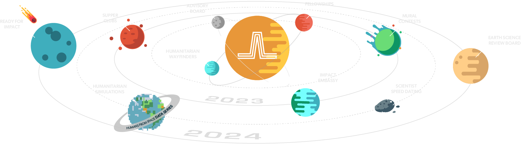
10 Programs for the Lifelines Community
How to Get Involved if you are a
Humanitarian

Humanitarian Wayfinders
The NASA Lifelines Humanitarian Wayfinders program annually unites 3-5 diverse organizations to enhance Lifeline initiatives, guiding design, bolstering community engagement, and promoting innovation, in tandem with NASA’s Applied Sciences division, to weave data into humanitarian efforts and foster skillful collaborations.
Impact Embassy
Impact Embassy is a hybrid roadshow highlighting Earth science’s significance, presenting Impact Hub content, and recruiting varied talent for key roles, targeting diverse communities by touring institutions like MSIs, HCBUs, tribal colleges, and a wide range of organizations and associations.
Mural Contests
This contest is a six-year art initiative that engages local artists and communities to create murals in frontline areas, showcasing the intersection of Earth science and humanitarian efforts.
Advisory Board
Recognizing the importance of external expertise, the NASA Lifelines Advisory Committee offers strategic guidance on program outcomes, while advisors amplify community strength, extend participation networks, and advise on fund allocation based on their seasoned experience.
Humanitarian Simulations
Humanitarian Simulations are global competitions fostering innovation and collaboration to address pressing humanitarian challenges using Earth observation data.
Ready for Impact
The NASA Lifelines Ready for Impact program will operate as a pitch competition for humanitarian-earth science teams looking to scale proven innovations.How to Get Involved if you are a
Scientist/ Researcher


Supper Clubs
The Supper Clubs are in-person, informal dinner events that will facilitate community building and discussions around high priority topics ranging from ethics around use of Earth science to centering local experts and frontline communities.Impact Embassy
Impact Embassy is a hybrid roadshow highlighting Earth science’s significance, presenting Impact Hub content, and recruiting varied talent for key roles, targeting diverse communities by touring institutions like MSIs, HCBUs, tribal colleges, and a wide range of organizations and associations.
Scientist Speed Dating
The NASA Lifelines Scientist Speed Dating is an incubator program that brings Earth Scientists and other scientific experts together to engage in interdisciplinary projects that address humanitarian challenges.
Humans from Space Data Series
The Humans from Space Data Series aims to address humanitarian data gaps using high-quality Earth Observation (EO) tools, refine existing resources for humanitarian use, enhance data visibility and accessibility, prioritize open datasets, streamline tracking of dataset usage, highlight NASA’s contributions to high-resolution imagery for humanitarian efforts, and serve as an engagement tool, while providing analytics and facilitating cross-sector comparisons.
Earth Science Review Board
The Earth Science Review Board, housed within the Impact Hub, brings together a diverse team of interdisciplinary Earth science experts to advise government, humanitarian, and donor organizations on optimizing program design for equitable impact.How to Get Involved if you are a
Funder
Impact Embassy
Impact Embassy is a hybrid roadshow highlighting Earth science’s significance, presenting Impact Hub content, and recruiting varied talent for key roles, targeting diverse communities by touring institutions like MSIs, HCBUs, tribal colleges, and a wide range of organizations and associations.Ready For Impact
The NASA Lifelines Ready for Impact program will operate as a pitch competition for humanitarian-earth science teams looking to scale proven innovations.Earth Science Review Board
The Earth Science Review Board, housed within the Impact Hub, brings together a diverse team of interdisciplinary Earth science experts to advise government, humanitarian, and donor organizations on optimizing program design for equitable impact.Supper Clubs
The Supper Clubs are in-person, informal dinner events that will facilitate community building and discussions around high priority topics ranging from ethics around use of Earth science to centering local experts and frontline communities.How to Get Involved if you are a
Policymaker
Impact Embassy
Impact Embassy is a hybrid roadshow highlighting Earth science’s significance, presenting Impact Hub content, and recruiting varied talent for key roles, targeting diverse communities by touring institutions like MSIs, HCBUs, tribal colleges, and a wide range of organizations and associations.Ready For Impact
The NASA Lifelines Ready for Impact program will operate as a pitch competition for humanitarian-earth science teams looking to scale proven innovations.Earth Science Review Board
The Earth Science Review Board, housed within the Impact Hub, brings together a diverse team of interdisciplinary Earth science experts to advise government, humanitarian, and donor organizations on optimizing program design for equitable impact.Supper Clubs
The Supper Clubs are in-person, informal dinner events that will facilitate community building and discussions around high priority topics ranging from ethics around use of Earth science to centering local experts and frontline communities.Current Programs
Humanitarian
Wayfinders
The NASA Lifelines Humanitarian Wayfinders program annually unites 3-5 diverse organizations to enhance Lifeline initiatives, guiding design, bolstering community engagement, and promoting innovation, in tandem with NASA’s Applied Sciences division, to weave data into humanitarian efforts and foster skillful collaborations.
Fellowship
Program
The NASA Lifelines Fellowship Program invites graduate students, especially from underrepresented backgrounds, to collaborate on Lifeline projects, facilitating their immersion in Earth Science for humanitarian goals and connecting them with industry leaders through mentorship, fostering a diverse network of innovation.
Impact
Embassy
Impact Embassy is a hybrid roadshow highlighting Earth science’s significance, presenting Impact Hub content, and recruiting varied talent for key roles, targeting diverse communities by touring institutions like MSIs, HCBUs, tribal colleges, and a wide range of organizations and associations.
Have questions?
Get in Touch
"*" indicates required fields